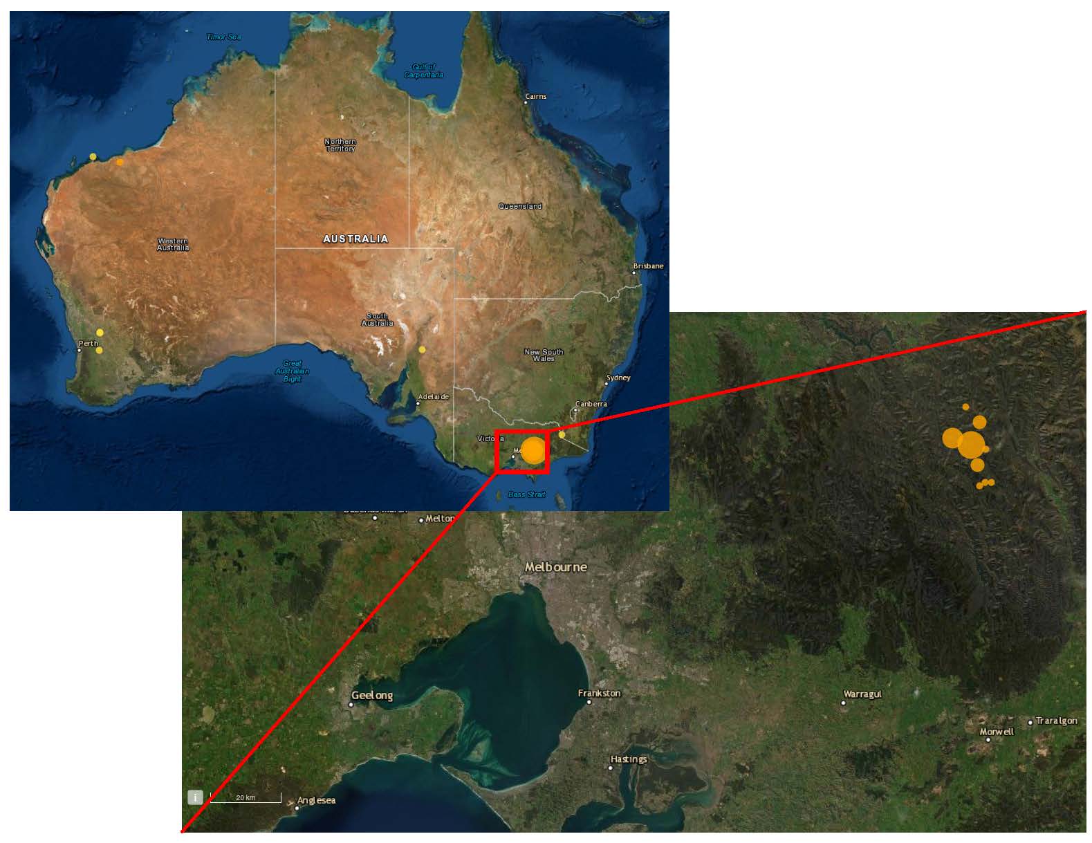
On Tuesday, September 21st, at 23:15 UTC time (01:15 on Wednesday morning Czech time), an earthquake of magnitude 5.9 occurred in southeastern Australia, about 200 km to the eastnortheast of the city of Melbourne.
Figure 1: Map of Australia with recent seismicity (last 7 days). The red square marks the region that is shown in the lower right zoom-in, which shows the city of Melbourne and the epicenters of the seismic sequence (modified from Geoscience Australia)
Although it is situated far from any plate boundaries, Australia hosts significant seismicity, with an earthquake of magnitude around 6 occurring on average every 3-5 years. These earthquakes occur because stresses from the edges of the Indo-Australian plate are transferred to its interior, where they can cause earthquakes on tectonically older faults and shear zones. Since Australia is very sparsely populated, most of these events do not affect a large amount of people.
The present earthquake, however, occurred in the southeast of Australia, only about 200 km ENE of the city of Melbourne (over 5 million inhabitants). Its mechanism shows that it featured strike-slip motion, likely along a roughly north-south striking regional fault. With its shallow depth of about 10 km, the quake led to rather strong shaking in the metropolis. No casualties have been reported to date, but minor damage to buildings as well as widespread panic were observed. Several aftershocks have occurred, the largest of which reached magnitude 4.1.
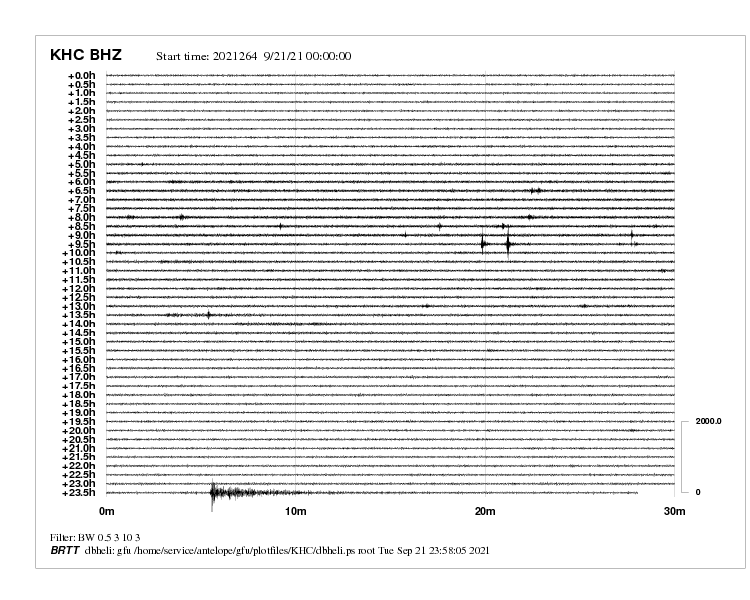
Figure 2: Recordings from the Kasperske Hory seismic station. Despite its location on the other side of the planet, the Australian earthquake is clearly visible in the last row, at a time of approximately 23:36 (UTC).


