Recent swarm activity in the western Bohemia/Vogtland region
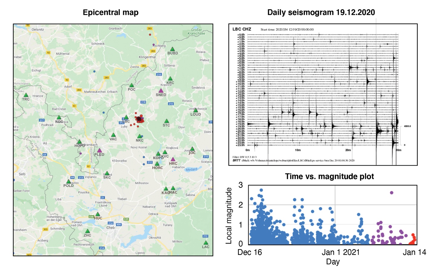
Increased seismic activity has been observed in the western Bohemia/Vogtland region during the past month, starting on December 16, 2020, north of Novy Kostel near Luby (Fig. 1). Most of the events at the beginning of the swarm were very small, less than the local magnitude (ML) 1, and occurred at depths between 9 and 10 km. The highest seismic rates were observed from December 18 till December 22, when the seismic network recorded more than 1,000 earthquakes, including 7 events > ML 2.0. The seismic rates have been declining since then, yet, relatively strong events may still occur as demonstrated by the January 10, 2021 ML 2.6 event. Altogether, the seismic swarm counted almost 1500 instrumentally recorded events.
Fig. 1 – 2020/2021 seismic swarm north of Novy Kostel
The western Bohemia/Vogtland region has long been known for recurrent earthquake swarms, that is, sequences of relatively small-magnitude earthquakes that occur locally within a relatively short time. The time period is variable and commonly ranges between days and weeks. Unlike mainshock-aftershock sequences, earthquake swarms do not contain a main, large-magnitude earthquake but rather comprise a series of small-to-moderate events. In western Bohemia, the earthquake magnitude rarely exceeds 3 of the local magnitude scale. Most of these earthquakes are too weak to be noticed by people living in the epicentral area. However, a few events stronger than ML 4, which may potentially cause light damage to structures, have been observed during swarm activity since 1900.
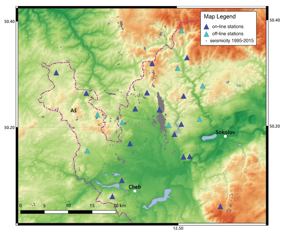
Earthquakes in the region have been monitored by the real-time seismic network WEBNET that comprises 25 seismic stations deployed in a grid around the fault system (Fig. 2). Eight significant swarms have occurred since the start of systematic research in the region in the 1980s. Three major swarms occurred before 2000: in 1985, 1997, and 2000, and were followed by five swarms in 2008, 2011, 2014, 2017, and 2018. High-resolution observations from WEBNET allowed for detailed mapping of the steeply-dipping fault zone and upward migrating swarm seismicity, which is likely linked to the migration of fluids in the earth’s crust.
Fig. 2 – The WEBNET seismic network with earthquake epicenters
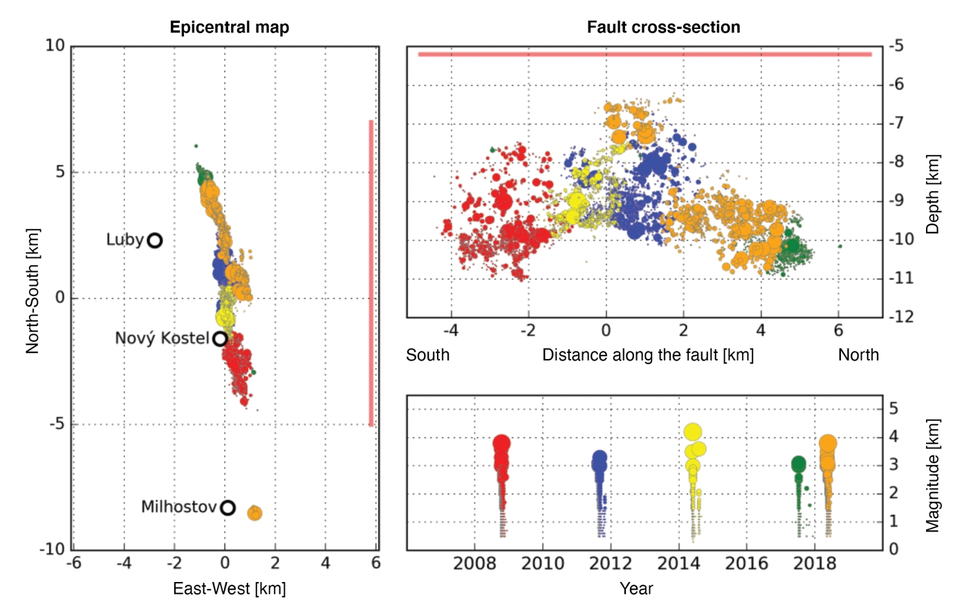
The hypocenters of five swarms from 2008 to 2018 illuminate about 10-km long segment of the fault at depths between 6 and 12 km. Fig. 3 shows the location of the fault as displayed by the distribution of earthquake epicenters, a section along the strike of the fault, and earthquake magnitudes in time.
Fig. 3 – Earthquake activity in western Bohemia/Vogtland region between 2008 and 2018. Individual swarms are distinguished by colors


