
Antarctica has long drawn explorers and scientists to investigate the icy continent from the heroic feats of the first expeditions by James Ross, Roald Amundsen, Robert Falcon Scott and Ernest Shackleton to the far more comfortable efforts by the scientists of today. Antarctica is a key piece in the puzzle for understanding global continental evolution, including volcanism. It contains examples that define the spectrum of Earth’s magmatic and volcanic processes.
Mount Erebus, on Ross Island, is considered an end-member example of CO2 dominated rift volcanism in contrast to the more common H2O dominated rift volcanism of the pacific rim and elsewhere associated by plate subduction.
Understanding the magma ascent from deep mantle source remains a driving unresolved question of extensional volcanism like that of Mount Erebus. Results from a new study by Graham Hill and co-authors published in Nature Communications shows how CO2 deep underground helps magma avoid being trapped deep in the Earth and allows it to reach and pool at the surface.
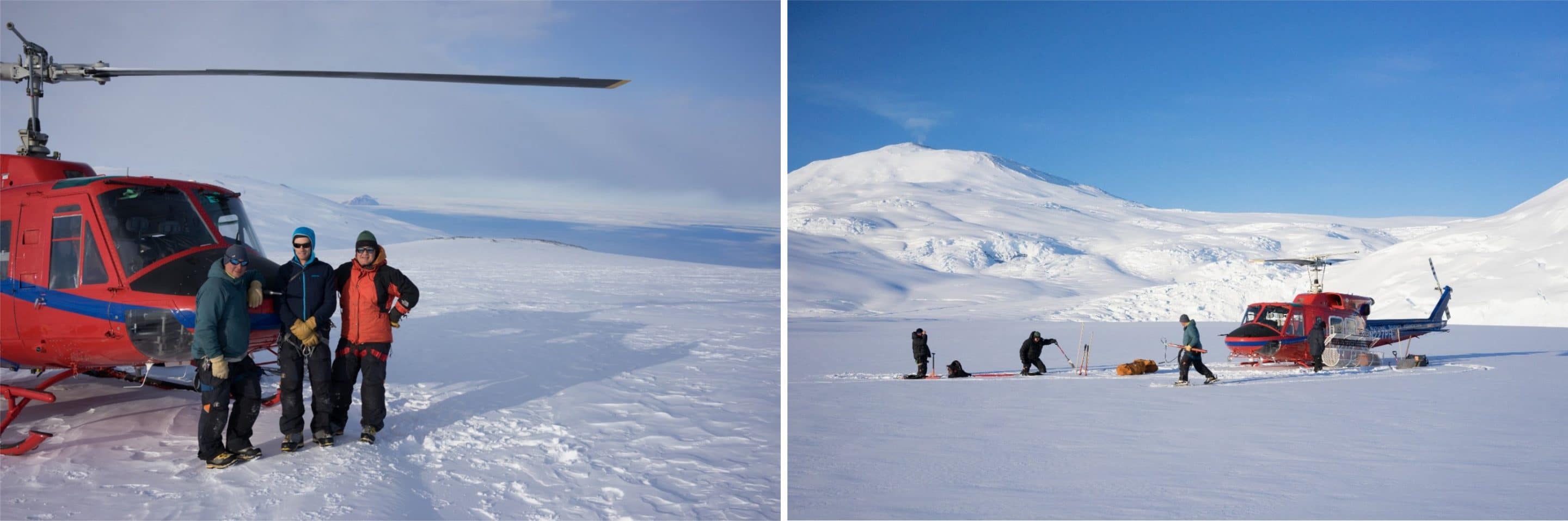
Left: On the southern flanks of Mount Erebus Ross Island, Antarctica. From left to right: Graham Hill (geophysicist), Danny Uhlmann (IFMGA mountain guide & geologist), and Phil Wannamaker (geophysicist). Right: Setting up a magnetotelluric site via helicopter support in the Windless Night area of Ross Island which Mount Erebus in the background. From left to right: John Stodt, Phil Wannamaker, and Graham Hill. Photo credit: Danny Uhlmann by permission.
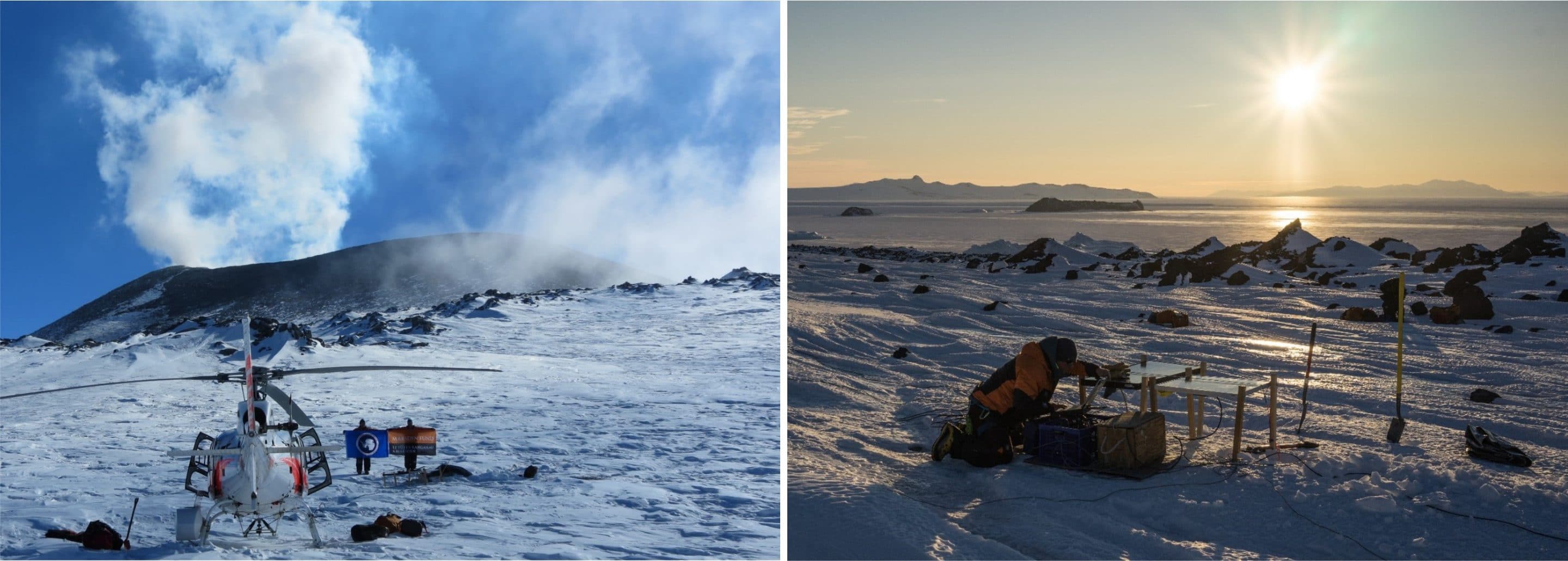
Left: Phil Wannamaker (left) and Graham Hill (right) at an magnetotelluric site near Erebus crater rim, holding the flags of the U.S. Antarctic Program and the New Zealand Royal Society Marsden Fund. Photo credit: Mark Deaker by permission. Right: Graham Hill checking an magnetotelluric site near Cape Evans on Ross Island with the Transantarctic Mountains in the background. Photo credit: Danny Uhlmann by permission.
Corresponding author: Graham Hill
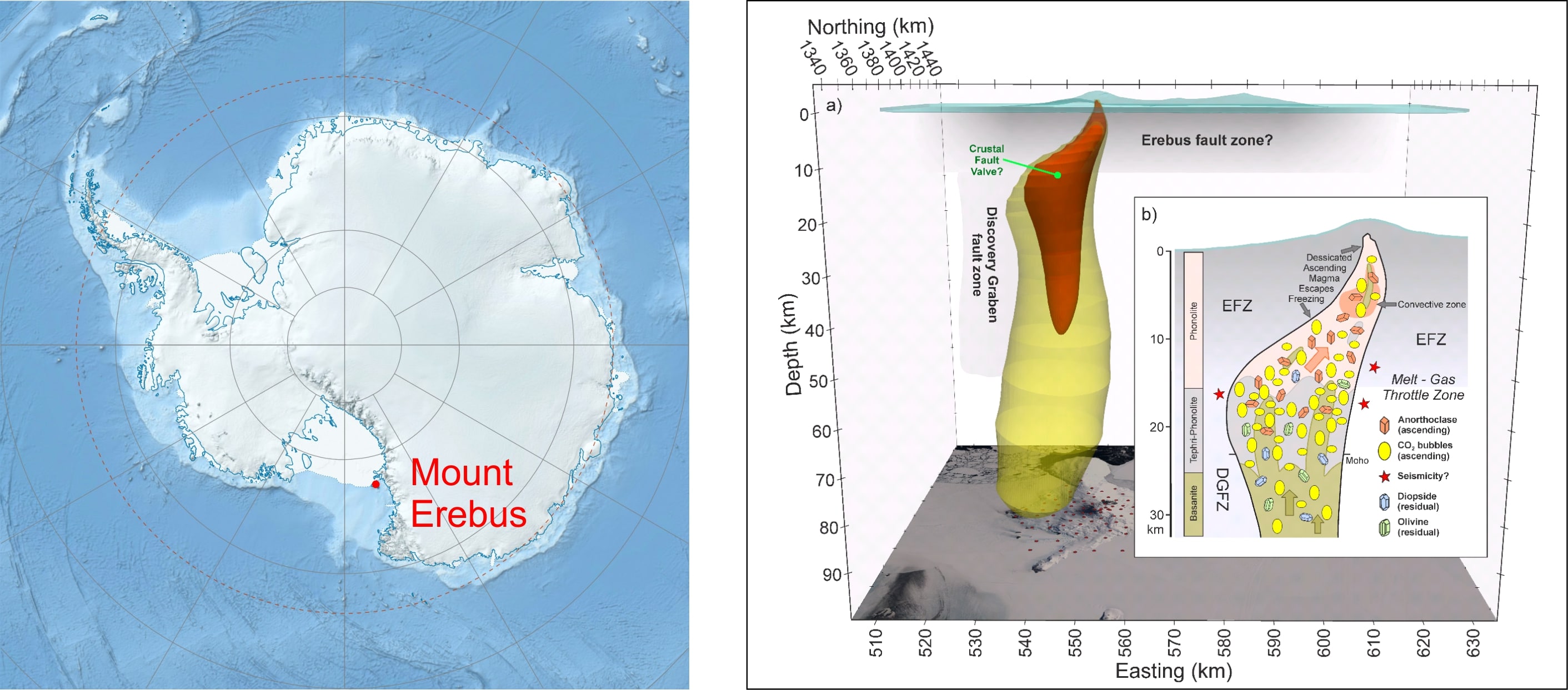
Left: Map of Antarctica showing location of Mount Erebus. Source: Wikimedia (modified). Own work Data from http://nsidc.org/data/moa/ – Haran, T., J. Bohlander, T. Scambos, and M. Fahnestock compilers. 2005. MODIS Mosaic of Antarctica image map. National Snow and Ice Data Center, digital media. Metadata for Antarctica’s Coastline and Ice Sheet Grounding Line Files: http://nsidc.org/data/docs/agdc/nsidc0280_scambos/. ETOPO1 Ice Surface: Amante, C. and B. W. Eakins, ETOPO1 1 Arc-Minute Global Relief Model: Procedures, Data Sources and Analysis. NOAA Technical Memorandum NESDIS NGDC-24, 19 pp, March 2009. CC: CC BY-SA 3.0
Right: 3D visualization from the magnetotelluric scan of Erebus interior. Source: Hill, G.J., Wannamaker, P.E., Maris, V., et al. Trans-crustal structural control of CO2-rich extensional magmatic systems revealed at Mount Erebus Antarctica. Nature Commun 13, 2989 (2022).
Author: Graham Hill