
Two large earthquakes occurred on the island of Taiwan on Saturday and Sunday (September 17; 14:41 Czech time and September 18; 07:44 Czech time), reaching magnitudes of 6.5 and 6.9. Both events (referred to as the Taitung earthquakes) were observed in the southeast of Taiwan, at shallow depths of about 10 km. 142 injured people have been reported to date, and many houses and other infrastructure were damaged, in part also by landslides that were caused by the shaking.
The island of Taiwan is located within a complex plate boundary setting that involves a total of four tectonic plates. The Philippine Sea Plate subducts northwards under the European plate to the northeast of Taiwan, whereas to the south of the island, the Sunda Plate subducts eastward under the Philippine Sea Plate (see Figure 1). In the center of these two subduction zone segments, the island of Taiwan itself experiences a continental collision that has created its high mountains.
The two earthquakes this weekend occurred in the southeast of Taiwan, close to the boundary between the Eurasian and Philippine Sea Plates. First preliminary statements by local seismologists indicate they may have ruptured a previously unidentified fault in this region.
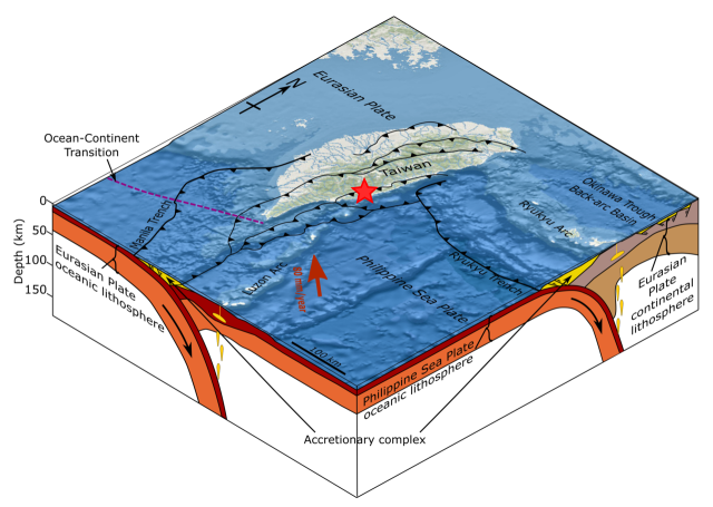
Fig 1: 3D block diagram of the tectonics around Taiwan with epicenter indicated with red star (CC BY-SA-4.0_author Mikenorton_wiki, modified: added red star – epicenter)
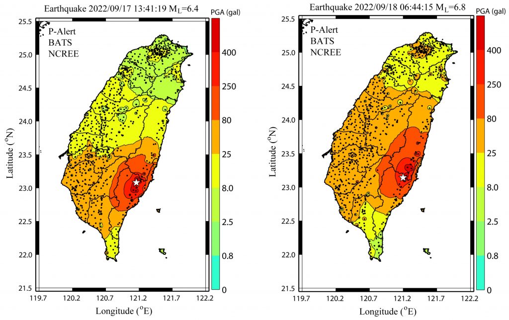
Fig 2: Peak ground acceleration (PGA) hazard maps. Source: https://www.facebook.com/Palert.Shakemap/
Links for further information
– USGS (United States Geological Survey):
https://earthquake.usgs.gov/earthquakes/eventpage/us7000i90q/executive
https://earthquake.usgs.gov/earthquakes/eventpage/us7000i8ui/executive
– IRIS (Incorporated Research Institutions for Seismology) for waveforms and moment tensors:
https://ds.iris.edu/ds/nodes/dmc/tools/event/11599165
https://ds.iris.edu/ds/nodes/dmc/tools/event/11598962