
A magnitude 7.6 earthquake hit Mexico’s central Pacific coast on Monday at 1:05 pm local time, killing at least one person and damaging buildings in the epicentral region. The earthquake hypocenter was located 23 miles southeast of Aquila at the depth of about 10 miles. Strong shaking lasting for more than a minute also hit the country’s capital, Mexico City. So far, the earthquake has been followed by two noteworthy aftershocks with a magnitude of 5.3 and 4.5. Coincidentally, September 19 is the anniversary of two other strong earthquakes that devastated Mexico in 1985 (magnitude 8.0) and 2017 (magnitude 7.1). Despite the coincidence, there is no direct link between these events or increased risk of seismic events at this time of the year.
The earthquake occurred as the result of the subduction of the Cocos oceanic lithospheric plate underneath the North American plate. The earthquake parameters suggest that it happened at or close to the interface between the two lithospheric plates. Although earthquakes are commonly denoted as points on maps, large earthquakes slip over a large portion of a fault. It is estimated that the September 19 event has ruptured a fault segment about 90×40 km in size.
The epicentral region of the September 19 event has been highly seismically active, experiencing 13 events stronger than magnitude 6.5 in the past 50 years. Two of the earthquakes (1985 and 1995) exceeded magnitude 8.0.
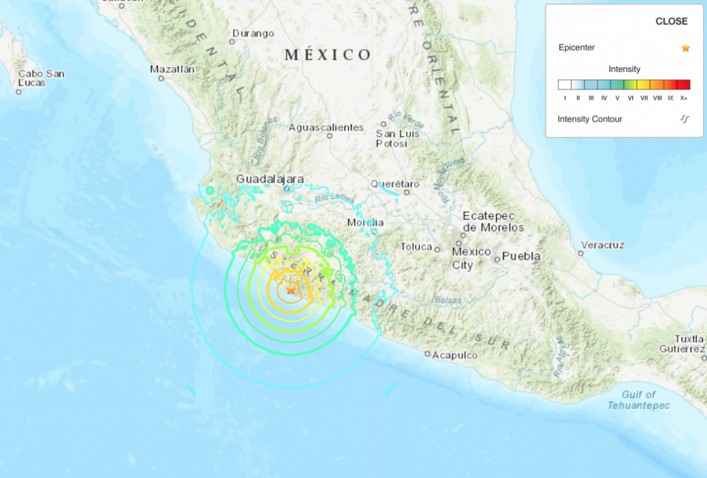
Figure: The epicenter of the September 19 earthquake and shaking intensity
Sources:
NPR, https://www.npr.org/2022/09/19/1123941244/mexico-earthquake-michoacan-colima-damage, accessed 9/20/2022 at 10 am.
USGS, https://earthquake.usgs.gov/earthquakes/eventpage/us7000i9bw/executive, accessed 9/20/2022 at 10 am.