
On Sunday morning, September 11, at 01:47 Czech time (23:47 on September 10 UTC), a large earthquake of magnitude 7.6 occurred in the east of Papua New Guinea, at a depth of 90-100 km. While most large earthquakes around the world happen directly on the contact between two tectonic plates, the deep depth of the Papua New Guinea event tells us that it occurred inside the Australian Plate, which here subducts in a tight arc under the Pacific plate (see Figure).
At 100 km depth, the ambient pressure due to the overlying rock masses is so high that earthquakes (i.e. sliding of rocks relative to each other) are normally not even possible. However, the downgoing plate contains water that is bound in different mineral types, and these mineral types release the water when they get hot enough. The released water then makes it easier for rocks to slide against each other, thus enabling earthquakes in specific places. While such “intraslab” earthquakes that occur because of water release are common, they only very rarely get as big as the one offshore Papua New Guinea on September 11.
Since the northeast of Papua New Guinea is very remote and earthquakes at large depths usually produce weaker shaking at the surface, only few casualties and mild property damage have been reported so far.
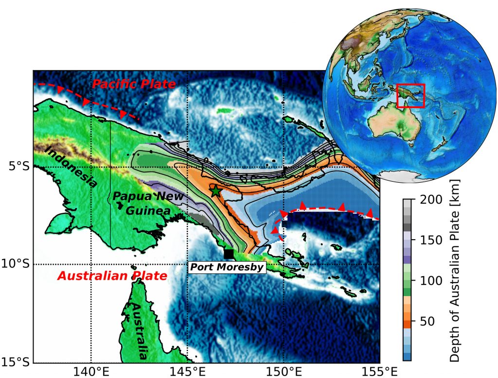
Figure: Map of Papua New Guinea, showing the location of the earthquake epicenter (green star) and the shape of the Australian plate that subducts under the Pacific plate here (see color scale).