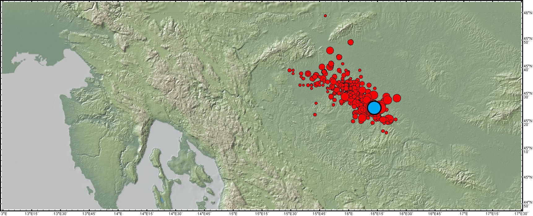
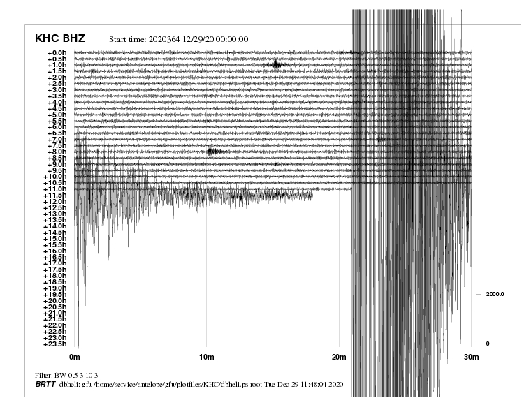
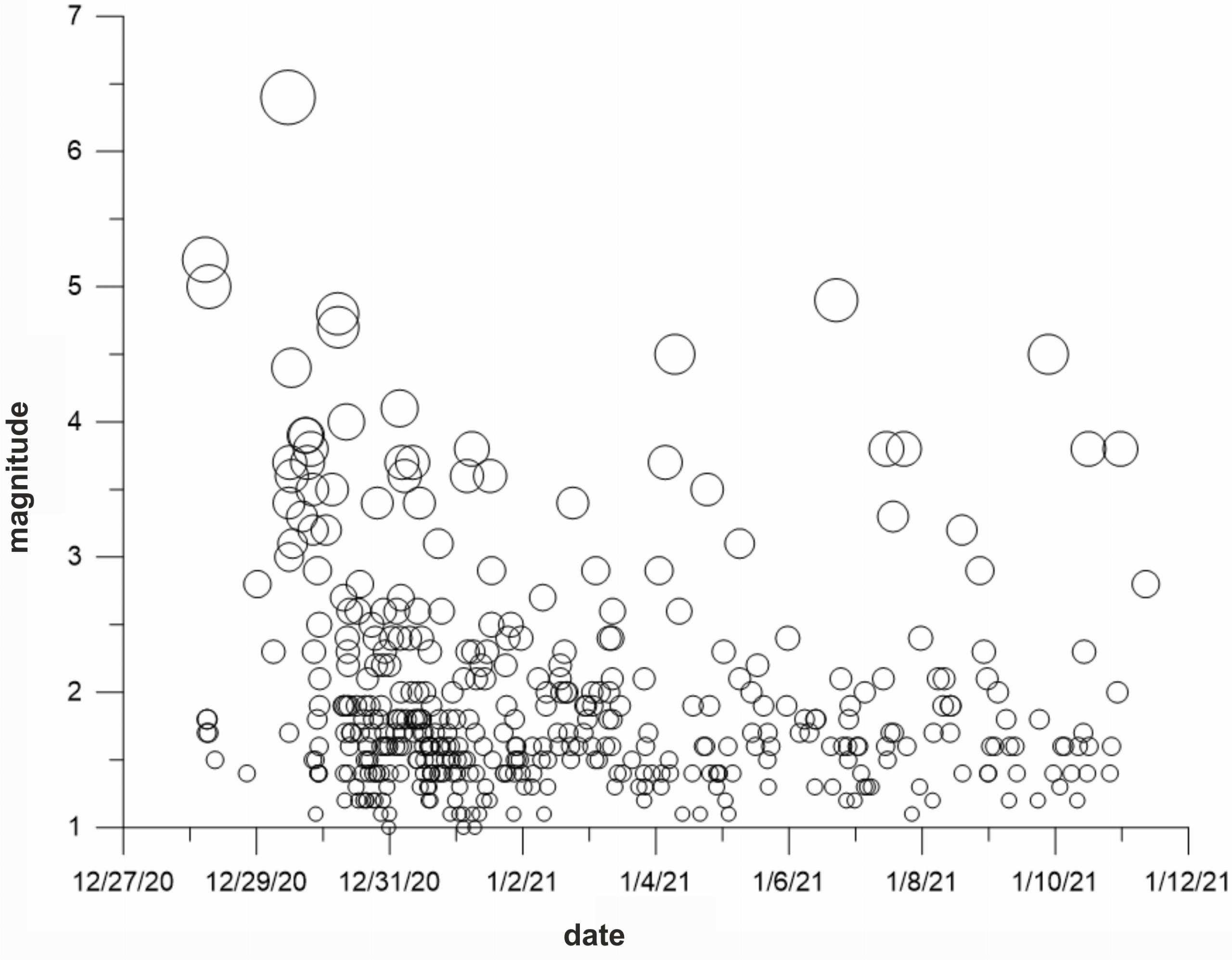
An earthquake of moment magnitude 6.4 struck the Kupa Valley area, central Croatia, about 50 km SE from the capital Zagreb at noon on Tuesday, December 29th, 2020 (Figure 1 – blue circle). Hypocenter of the earthquake was at a depth of about 10 km. The earthquake heavily damaged the town of Petrinja with 24,000 inhabitants, seven of which were confirmed dead. The earthquake was preceded by two felt earthquakes of magnitude 5.2 and 5.0, respectively, a day before. The earthquake was widely felt also at the territory of the Czech Republic (Fig. 2 – daily seismogram, station Kašperské Hory – KHC). The aftershock sequence of the earthquake is still in run (Fig. 3 – time plot). The European-Mediterranean Seismological Center EMSC has reported 428 earthquakes of magnitude 1.0 and larger since December 28, 2020 till January 12, 2021, 09:00 am (red circles in Fig. 1).
Fig. 1 – Epicentral map of a series of earthquakes (red circles) accompanying the destructive 6.4 Kupa valley earthquake (blue circle)
Fig. 2 – Daily seismogram of the 6,4 Petrinja/Kupa valley earthquake of January 29, 2020 recorded at the KHC (Kašperské Hory) station of the Czech national network of seismic stations
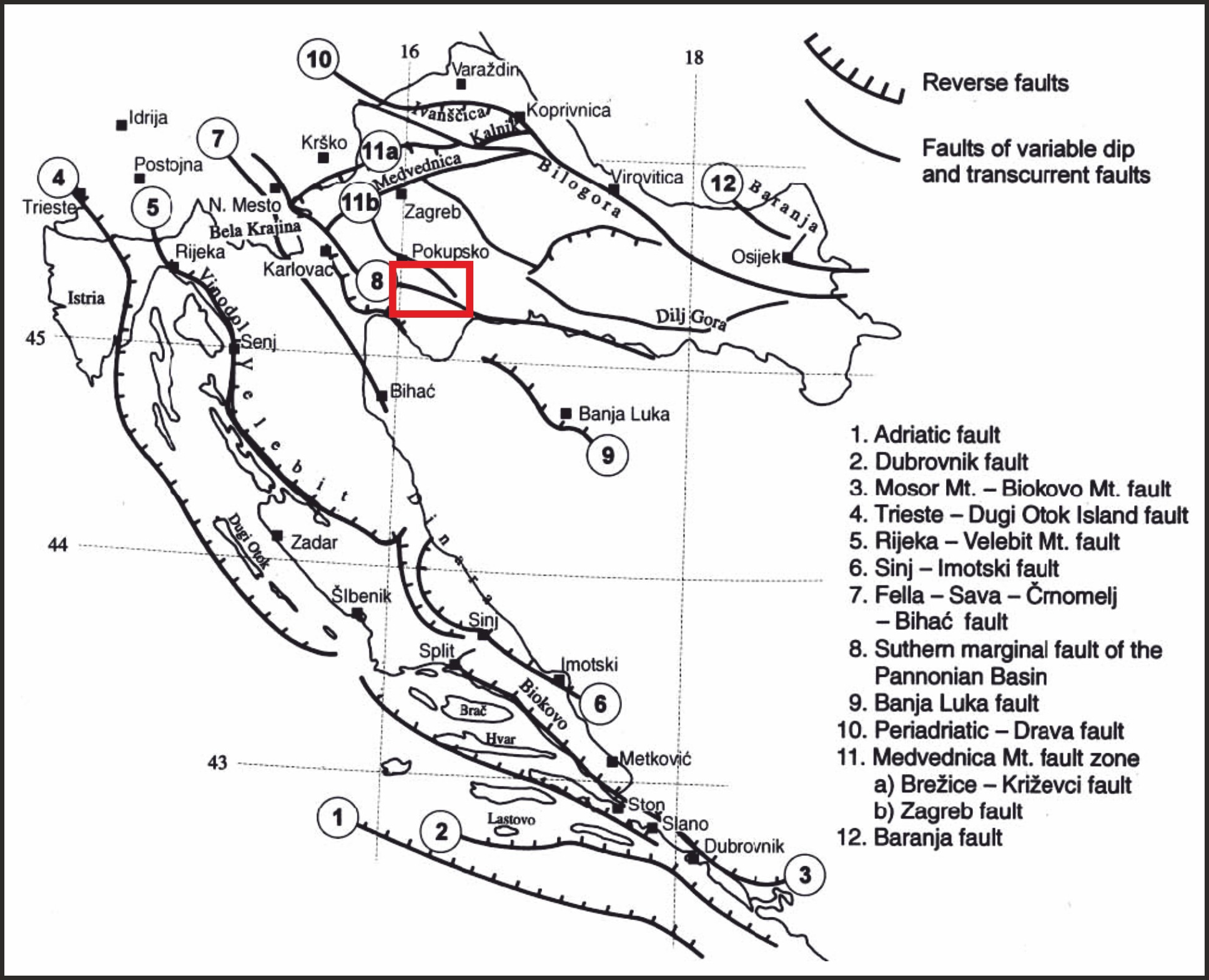
Croatia is situated close to the boundary between the Adriatic and the Eurasian lithospheric plates. The boundary runs parallels to the coast of Croatia beneath the Adriatic seafloor. In the continental part of Croatia, several significant European geological units neighbour: southeastern Alps, Dinarides, and the Panonian basin. These units are separated by significant fault systems. The recent earthquake and related events occurred along the fault system associated with the southwestern boundary of the Panonian basin (Fig. 4 – map of seismogenic faults). The strongest earthquake that has ever struck Croatia was the devastating Dubrovník earthquake in 1667 with about 5,000 victims. Magnitude of the strongest earthquakes of the 20th century did not exceed 6.1.
Fig. 3 – Time plot of the aftershock sequence of the 6,4 Petrinja/Kupa valley earthquake showing the gradual decay of the sequence
Fig. 4 – Map of seismogenic faults of Croatia after Markusic and Herak, 1998. The Kupa valley area is denoted by red rectangle
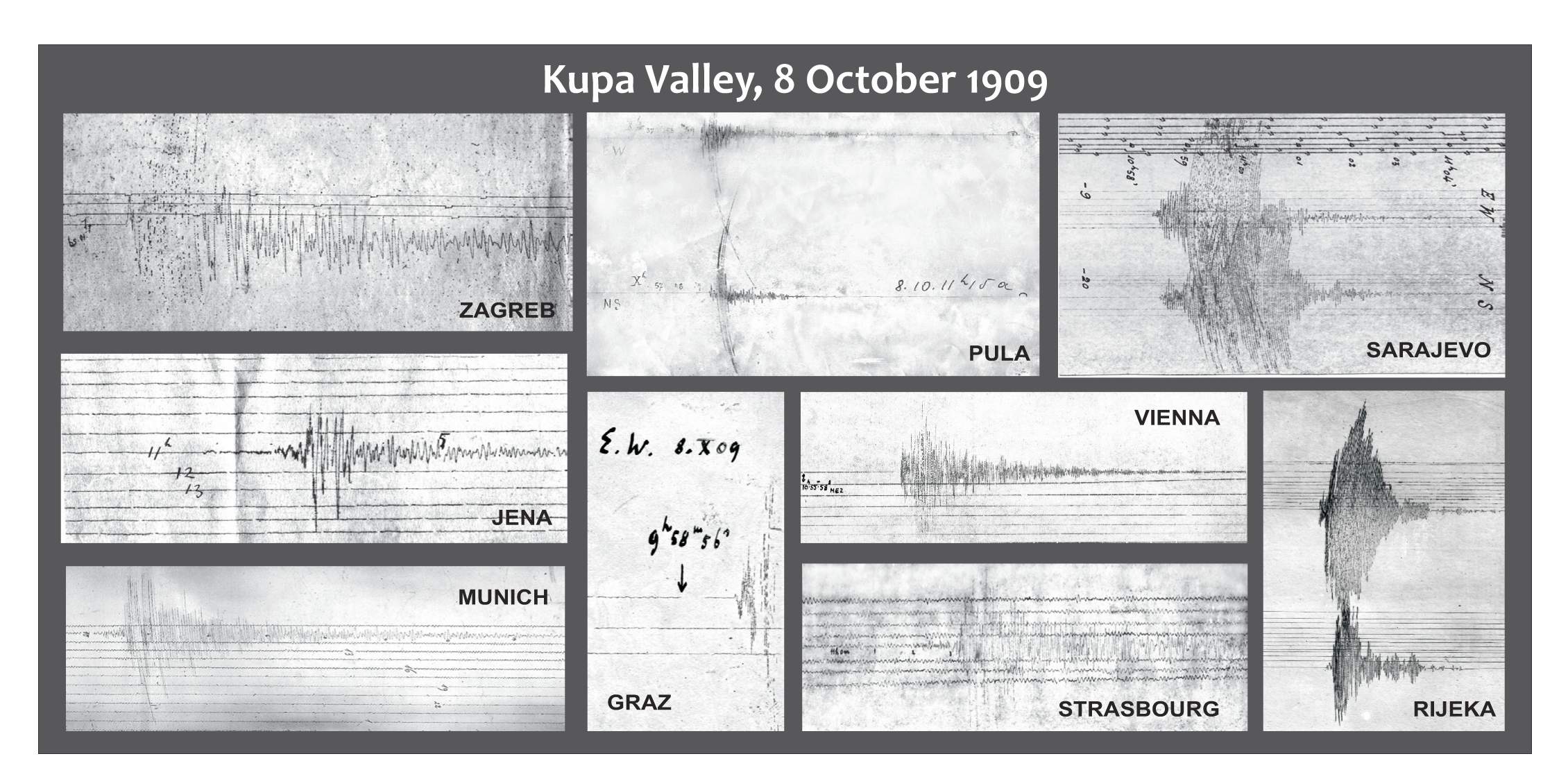
The Kupa valley area has not been much seismically active for more than 100 years. In 1909, an earthquake of magnitude 5.7 and of depth and mechanism similar to those of the current earthquake occurred there, followed by several felt earthquakes till 1914. The detailed analysis of seismograms of the 1909 earthquake enabled the outstanding Croatian geophysicist Andrija Mohorovičić to discover a significant velocity discontinuity between the Earth crust and mantle named the Moho ever since (Fig. 5 – seismograms studied by AM in 1909-1910).
Fig. 5 – Seismograms of the 5.7 Kupa Valley earthquake of October 8, 1909 assembled by A. Mohorovičić for the fundamental discovery of what was later named the Moho discontinuity (Herak and Herak, 2010)
Dr. Aleš Špičák
Director of the Institute


